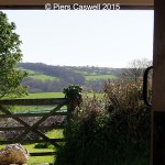
Soon as we arrived, we both looked to our left and just gasped "wow", what a view! Not to mention one of the best placed picnic bench's, on the edge of the car park overlooking the Chilterns and the Cotswolds. Perfect for those who are unable to walk far from the car, but want to enjoy a picnic with a view! The moment you enter the pasture, you cannot miss the giant white horse carved into the hill. Though you cannot appreciate the complete view from this perspective, being that both your close distance and the angle you are at obscures it's view.
Being ambitious and that we had plenty of daylight left, we thought we could squeeze in a second walk before heading home. We had just finished the walk at Wayland’s Smithy and Ashbury, we had contemplated picking up the ridgeway and walking onto Whitehorse hill (Walk No. 1).
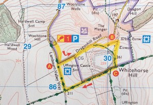
Maybe that was being a little too optimistic, being that to walk there was at least another 2.5 miles there and of course the same back. Considering our feet were already calling for a foot stool, we decided to drive to Woolstone hill and park up in the National Trust car park, from there it’s only another mile and half.
Without leaving the car, the views were already awe inspiring
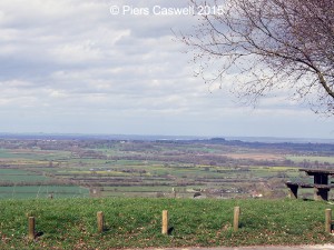
Soon as we pulled up, we both looked to our left and just gasped “wow”, what a view! There was even one of the best placed picnic bench’s, on the edge of the car park overlooking the Chilterns and the Cotswolds. Perfect for those who are unable to walk far from the car, but want to enjoy a picnic with a view!
We knew the this was going to be a spectacle and the weather was only just holding in there, with fairly clear views across the Downs.
You cannot miss the white horse at Uffington
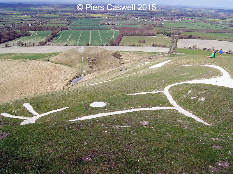
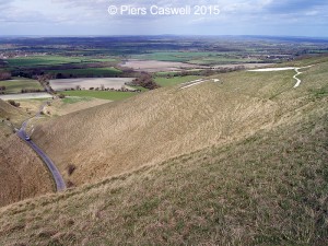
Soon as you enter the pasture, you cannot miss the giant white horse carved into the hill. Though you cannot appreciate the complete view from this perspective, being that both your close distance and the angle you are at obscures it’s view.
Aside from flying overhead, the best way to see the white horse in all its glory would be to head 10 plus miles in a northerly direction towards Carterton.
Getting up-close and personal with the chalky white horse
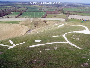
For a “green walk” (in our walking guide book) there is a little bit of climb as you leave Dragonhill road, but nothing too demanding. When we got to the top of the prehistoric carving, it was interesting identifying exactly what we were looking at, aside from these wonderfully white, large chalky markings.
Being that there was a white circle contained within an enclosed shape, and that it was the highest point, we guessed it would have to be the head with its eye.
It is really an impressive archaeological hillside carving and that it’s estimated to be over 3000 years old, ahh the mind ponders as you wander pass history.
- Standing at the White Horse facing towards the Cotswolds
- Atop of the prehistoric Uffington White Horse, near it’s head
- Standing by the White horse towards the Chilterns
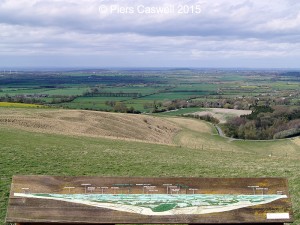
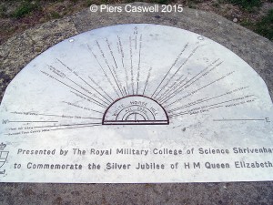
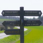
- Viewing point from Whitehorse hill
Did you know
With chalk filled trenches of over a meter deep (2-3 foot) and three meters in width, the White Horse at Uffington stands proud at 33 meters in height and 114 meters in length.
The legend of St George and Dragon Hill
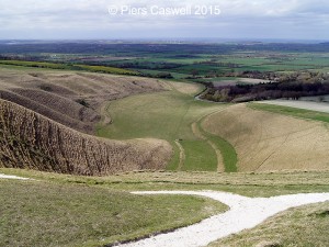
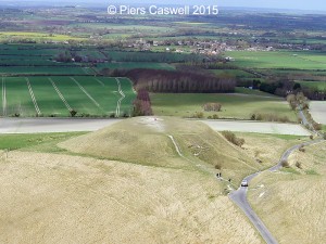
At the time, we both stood there at the top of the white horse pondering what that strange flat-topped mound (or hillock) in the valley beneath was all about, the map stated it was called Dragon Hill. Only later after we returned, that I hopped onto Google to find out more, most of the on-line sources are fairly similar, and this is what I found:
Dragon Hill is a low flat-topped mound situated in the valley below the White Horse. In legend it is the place where St George slew the dragon, its blood spilling on the hilltop and leaving forever a bare white patch where no grass can grow. Some suggest that the horse is a representation of St George’s steed or even of the slain dragon itself.
Source: Mysterious Britain
Only a few hundred yards further up Uffington Castle once stood
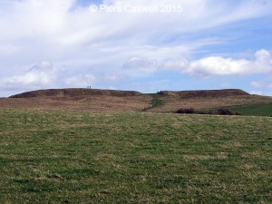
With this walk everything is so close, you only have to walk a few hundred yards further towards the summit, and there you see the remains of the ramparts (earth mounds) of this Iron Age hillfort. By the time we started exploring Uffington Castle, the weather had turned for the worst and the wind had picked up.
Unfortunately this cut our trip short, as it was hard to see in the almost horizontal rain, plus standing at the very top of this hill you really felt the brunt of the gale, as you attempted to stay on your feet.
- Uffington Castle – Old Iron Age fort
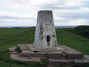
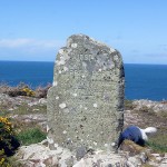
- Monument forms part of the Ordnance Survey National GPS Network
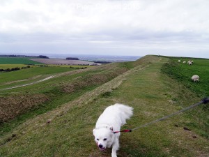
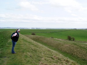
- Walking along the ramparts
- Flying away from the old ramparts
- White horse hill view point
Did you know
Uffington Castle was believed to have been built between two tribal boundaries along the (ridgeway) prehistoric trade route. Iron Age coins were found during the excavation of the castle in the 1850’s that was believed to belong to the Dobunni tribe.
Walk review: Uffington Castle and the White Horse
Apart from the changing weather towards the end of our walk and fact we were already fairly tired from our earlier walk at Wayland Smithy, we both enjoyed this short (what felt like a) bonus trip.
As you can imagine, it was a little bit touristy so it can get quite busy, but as it was only just over a mile round trip and was fairly easy to walk, it was well worth it.
There is plenty of free parking and several picnic benches to stop and enjoy the majestic views.
The White Horse and Uffington Castle walk details
Here are the walk specifics collated from several different written sources, which include the readings from our pedometers on a typical ramble. For more detailed information please purchase one of these fantastic walking guides or source the information on-line.
Distance
1.57 Miles (2.53km)
Time required
1 hour, most of the time spent will be admiring the views.
Gradient / Ascent
43 Metres (141ft)
Parking
Plenty of spaces available at Woolstone Hill National Trust car park.
Food / Refreshments
No, but there is tea room nearby and a pub.
Difficulty
Easy, though a slight uphill from the car park
Acessibility / Path
Not wheelchair friendly. Couple of narrow paths, one road and lots of grassland in the fields.
Dog friendly
Yes, but keep on a lead. Sheep freely roam the fort remains.
Maps
Explorer 170 Abingdon, Wantage & Vale of White Horse
Landranger 174 Newbury, Wantage and surrounding area
Toilets
None
I have included a link to the traditional walking guide map, courtesy of Jarrolds Short Walks.
You can find detailed instructions (slightly different to the walk we took) of the walk on-line via either:
Though personally we prefer walking guide books and marking off the walks we have completed.
On the right is appropriate quick link Google map for Uffington white horse car park at Woolstone hill, which is the starting point for this short walk.
As you can see on the map if you drag it left, the Castle and White Horse are all within a very short distance.
There is ample parking, with picnic tables.
Public Transport
This walk is not easily accessible via public transport using the following services:
- Train Station: Nearest is Swindon, but you will require a Taxi
- Bus services: Along the B4507 Swindon-Ashbury-Uffington or Faringdon-Uffington-Wantage
Travelling by car
Arriving by car, there is parking available at the Pot Kiln pub
- Coordinates: 51.577553, -1.578234
- Nearest post code: SN7 7QN
- OS Grid Ref: SU299863
[mashshare]

