It’s day one and we’re staying in a little village called Moylgrove in the Pembrokeshire National Park, only a mile from the sea at Ceibwr Bay. When we arrive at any holiday location, we are keen to find quickly find our feet, getting to know what’s available in our immediate proximity. With the sea so close it’s hard resisting that draw of the ocean and the temptation to explore the beach, especially when it’s only a mile away from you and you can see it from your cottage.

It’s day one and we’re staying at Banc Cottage in a little village called Moylgrove in the Pembrokeshire National Park, only a mile from the sea at Ceibwr Bay. When we arrive at any holiday location, we are keen to find quickly find our feet, getting to know what’s available in our immediate proximity.
With the sea so close it’s hard resisting that draw of the ocean and the temptation to explore the beach, especially when it’s only a mile away from you and you can see it from your cottage.
Not a jiffy in our walking guide books for Ceibwr bay
Without any guide books or maps we packed our bags and set off downhill towards Ceibwr Bay, with only the knowledge that the Pembrokshire Coastal path stretches all the way along the coast from Poppit Sands for 186 miles (299km) down to Amroth in the South.
Quite honestly we did not know what to expect or where we were going, but you cannot go far wrong (in theory) following a coastal path.
Ceibwr Bay is both wild and unspoilt
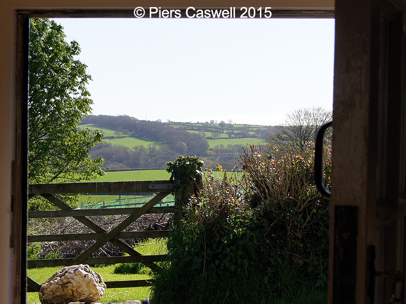
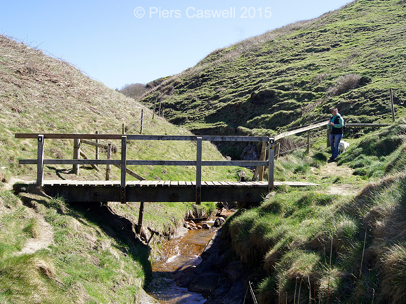
When we arrived, after passing the National Trust sign, we walked over this little stone bridge crossing the Ceibwr river, which has another alluring footpath, that runs parallel to the river, back up through the valley to Moylgrove.
First impressions were, it’s unspoilt, quiet and very wild! What a stunning little bay, we both really enjoyed exploring the beach and the rock pools, though unfortunately for us there was nothing much to find. The beach is very rough, littered with varying sizes of stones and small boulders, but is full of interesting wildlife.
The geological formations along the cliffs are spectacular, they have been folded and contorted due to shifting earth movements for the last 450 million years, apparently during the Caledonian era. Some of them so much so, we spotted what looks like a giant white ‘S’ on it’s side on one of the cliff peninsulas, which really highlights the extent of these movements.

Arriving at Ceibwr Bay, near Moylgrove
Did you know
In the 19th century before the railways, limestone and culm used to be transported to Moylgrove by flat bottomed vessels, picked up by horse and cart and taken to a local kiln. It would then be converted into burnt lime for reducing the acidity on the soil in the local fields.
To get a better look of the coastline we set our bearings South
Part curiosity, part chance we decided to head further South down the Pembrokeshire Coastal path, we passed plenty of local fauna, beautiful wild flowers, Yellow Wagtail (on the RSPB Red list) and to top it off a Kestrel hovering in the wind above its prey.
We had read that the coastline along this stretch of the coastal path at Moylgrove was dramatic and indeed it was true. Amongst the jagged rocks, there were countless caves, huge arches, blow holes and plenty of small secluded beaches that make up this wild and lonely coastline.
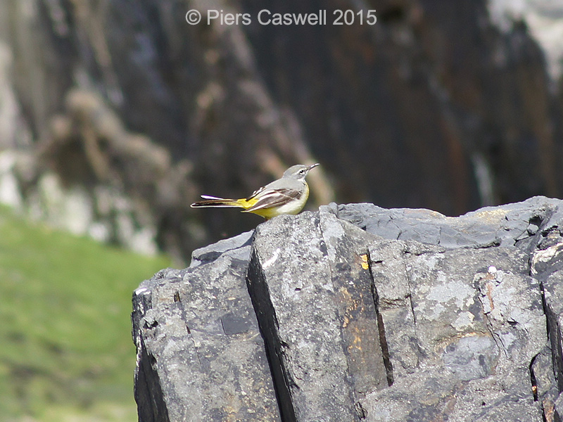
Friendly little Yellow Wagtail spotted in Ceibwr Bay
Further to the south lies The Witches Cauldron
It’s known as the Witches Cauldron (Pwll-y-Wrach), once a cave that’s roof collapsed during the Quaternary Period approximately 2 million years ago. On its South Easterly side, a stream disappears into the cauldron, whilst on the other there are a series of narrow underground passages connecting it to the sea. During high tide and stormy weather, the waves rushing through these tunnels then bubble and ‘boil’, acting as a blowhole, which I believe is why it is so aptly named. This is a sight I would love to see, though walking those cliffs in a storm might not be everyones cup of tea.
I understand that the Witches Cauldron draws a lot of attention during the summer from Wild Swimmers and Sea Kayakers making their way through during low tide. This video clearly shows a pair of young lad’s exploring the tunnels in their Kayaks, discovering a small waterfall within the tunnels which i believe to be where the stream enters.
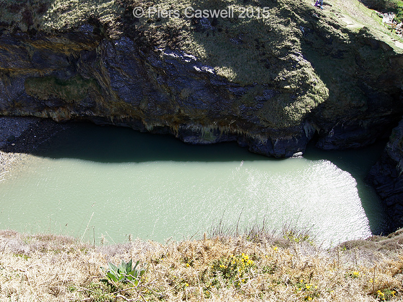
Looking down into the Witches Cauldron (Pwll-y-Wrach) near Moylgrove
Did you know
The Witches Cauldron is overlooked by an Iron Age promontory fort (300 BC) called Castell Treriffith (or Treruffydd).
-

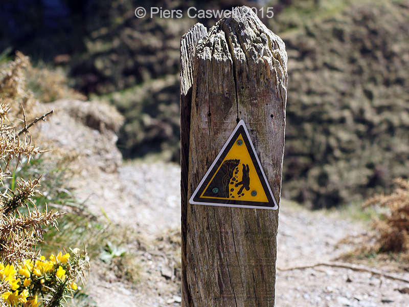
- Don’t fall into the bubbling Cauldron
-
- Looking down into the Witches Cauldron (Pwll-y-Wrach) near Moylegrove

-
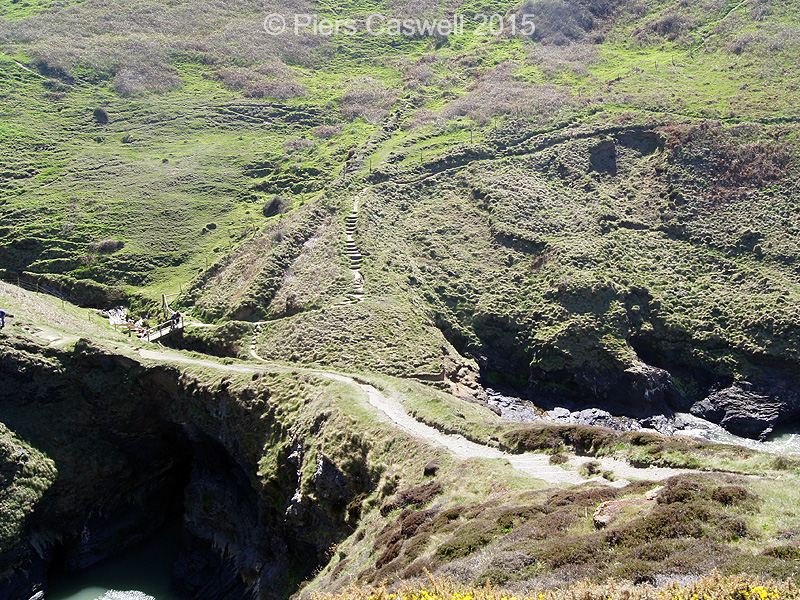
- On the lower left is the Witches Cauldron with it’s crossing
-
- Bridge crossing the stream
Though you cannot clearly see where the sea enters from upon high, you can immediately appreciate its potential for a small sheltered wildlife sanctuary for any species able to call this place home. We later found out that during September and October Atlantic grey seals can sometimes be found with their young on the beach below. Oh the photo opportunities here are exciting, if disruption is kept to a minimum.
Walk review: Pembrokeshire coastal path at Moylgrove & Ceibwr Bay
As I am sure you can tell, we really enjoyed exploring the Pembrokeshire coastal path at Moylgrove for our first day’s adventure. What more can you ask for, on your first walk of the week? stunning scenery in abundance.. check! rich wildlife diversity.. check! a rich and interesting history.. check!
The whole walk was about 5.34 miles, though for us that was door to door from our cottage up the hill in Moylgrove. There are plenty of steep climbs and descents as expected with cliff coastal paths. At times there were a few precarious stretches (if you suffer from vertigo), but nothing too challenging if you pace yourself.
We talked about bringing Sherrie’s parents (mid 60’s) maybe next time, but as they are both unsteady on foot and her father Paul is disabled, whom cannot walk far. We considered parking at Ceibwr bay and then helping them along the coastal path 1/4 mille to the Witches Cauldron.
This stretch of the Welsh coastline is without a doubt worth visiting, need I say more.
| Scenery: |  |
| Enjoyability: |  |
| Point of Interest: |  |
| Average: | |
Moylgrove through Ceibwr Bay and onto the Witches Cauldron walk details
Here are the walk specifics taken from our MapMyWalk tracking app and details available locally, which include the readings from our pedometers on this refreshing coastal ramble.
Distance
5.33 Miles (8.58 km)
Time required
2 hours on an average pace and fair weather conditions.
Gradient / Ascent
145 Metres (476 ft)
Parking
Spaces available at Ceibwr Bay National Trust car park or Moylgrove village
Food / Refreshments
Not on route, unless you detour uphill to Penrallt Garden Centre
Difficulty
Several ascents and descents, that can be mildly challenging on the knees.
Acessibility / Path
Not wheelchair friendly along the coastal path, however, accessible to the coast from either of the roads to and from the coastline.
Dog friendly
Yes, but obviously kept on a lead on the roads.
Maps
Ordnance Survey ‐ Landranger 145 – Map of Cardigan & Mynydd Preseli
Explorer OL35 North Pembrokeshire
Toilets
No. Only at Penrallt Garden Centre
I have included a link to a map, courtesy of Ordanance Survey.
You can find detailed instructions of a similar walk on-line via:
Though for this one, we just picked a direction and walked
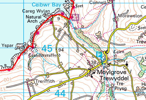
Image Source: Ordnance Survey
Well I found out that I can share our walks recorded on our MapMyWalk app, so here is a link to the recorded walk specifics.
On the right is appropriate quick link Google map for Moylgrove and Ceibwr Bay that covers the area of our walk.
At the time of writing Google Maps seems to be displaying the wrong position, so if it doesn’t show Moylgrove please use this short link instead: https://goo.gl/maps/PsksP
There’s a National Trust car park along the side of the road at the coast.
Public Transport
This walk is not easily accessible via public transport, however there is the Poppit Rocket bus service:
- Train Station: Nearest is Cardigan (or Newport) and will require a Taxi
- Bus services: Poppit Rocket 405
Travelling by car
Arriving by car, there is parking available at Ceibwr Bay
- Coordinates: 52.076906, -4.760354
- Nearest post code: SA43 3BU
[mashshare]
What did you think about the rugged coast at Moylgrove?
Related Posts
 Exploring the Pembrokeshire coastal path at Goodwick
- Wonderful walks around Newcastle Emlyn in the Teifi Valley
- The Castle, the dragon & the white horse Uffington
- We found there was Plenty of things to do near Swindon
- Off wandering around Wiltshire, with Wilton Windmill in sight
- Sunday walks around Newbury & the perfect pub lunch