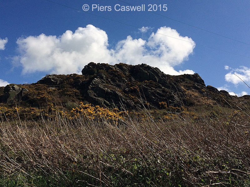
With only 14.5 miles to Goodwick, travelling down the A487 through Pembrokeshire Coast National Park. We were soaking up the spectacular scenery as we travelled through Newport and shortly after through Fishguard, both full of charm with plenty of character on our way to Goodwick.The display of wildlife alone made the walk memorable, aside from the beauty of the rugged coastline and the salty seas. Not of course forgetting all those swings in the valley!

Day three and we were off nice and early, we had pre-selected the walk the night before so we could quickly hit the road. We selected walk number 14 – Goodwick and Carreg Wastad point for an adventure further down the Pembrokeshire coastal path, instead of being inland again (We try to alternate locations, to keep it interesting.)
With only 14.5 miles to Goodwick, travelling down the A487 through Pembrokeshire Coast National Park. We were soaking up the spectacular scenery as we travelled through Newport and shortly after through Fishguard, both full of charm with plenty of character on our way to Goodwick.
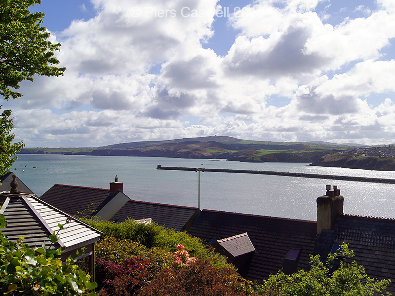
Stunning views over Fishguard Bay from the car park
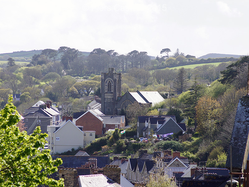
When we arrived, we basically parked in a local car park, with opposite views across Fishguard Bay and Fishguard Harbour, only a stone’s throw away from the Stena line ferry terminal to Ireland. If you just wanted to enjoy the scenery without the walk, you could sit in the car and enjoy the local fish and chips!
There was plenty of parking and was cheap as chips too (sorry for the chip puns, it’s approaching lunch time as I write this) for all day parking.
Only later did we realise that we had parked in the wrong car park, as suggested by our guide book.
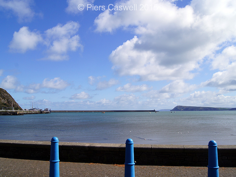
Sitting in the car park, this is your view of Fishguard Bay
Off we go towards Carreg Wastad Point
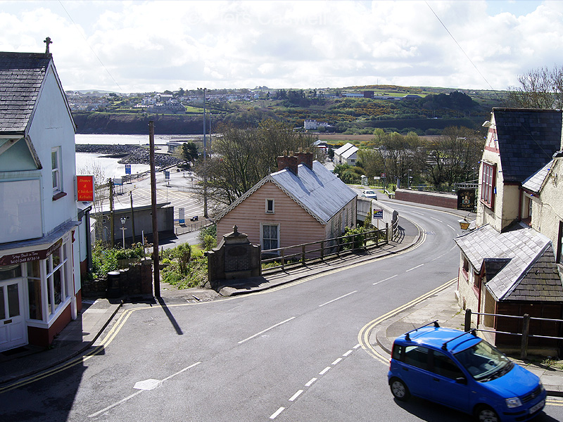
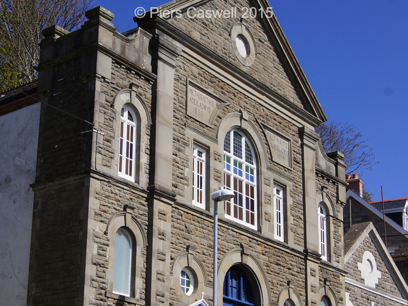
So as we left the car park, we starting the slog up New Hill road that runs up a steep hill running parallel behind the ferry terminal, we passed Berachah Presbyterian Church, built in 1830. At the time I commented to Sherrie that it was an unusual looking church, it was only later that we found out it was Protestant Church adhering to various modified forms of Calvinism.
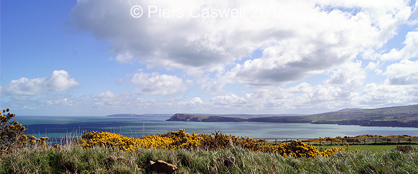
As we continued up what seemed a never ending hill, we were rewarded with those stunning panoramic views of the bay and in the distance there was Dina’s Head (another walk), whilst of course taking short breaks to take a few photos (and catch our breath).
-

- View of Goodwick and Fishguard from New Hill
-
- Berachah Presbyterian Church
-
- Views over Fishguard Bay and Dina’s Head
-
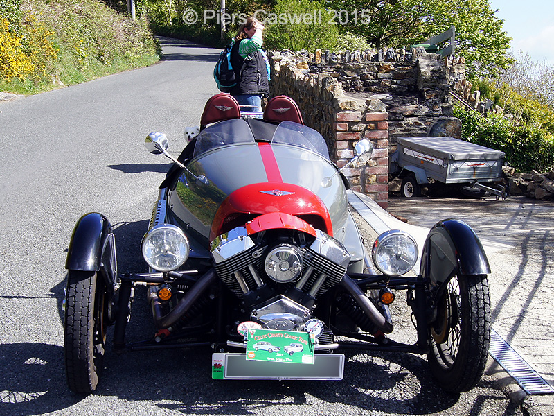
- An impressive vintage car, not sure what it is.
The Garn Wen Cromlechs burial chambers
As we left the Harbour village you pass through the Garn Wen Cromlechs (Cromlechi Garn Wen) three Neolithic burial chambers at the highest point, although we could only see one in a decent condition.
Apparently you could crawl under the capstone and into the chamber, though its position on the path and the fact there was plenty of dog shit about, it was not something we really wanted to investigate in any depth.
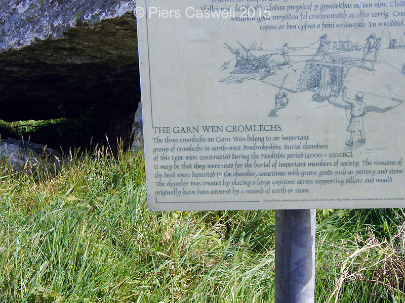
Garn Wen Cromlechs burial chamber
Did you know
This type of burial chamber was constructed during the Neolithic period between 4000 – 2500BC for important members of society, whom were occasionally buried with pottery and stone tools. (see the pic)
Though the almost 360 degree views were impressive and spurred on our enthusiasm to leave the village behind and begin exploring the coastal path further.
Dina's Head from Pwll Hir, Goodwick
What a treat to observe all the local wildlife
As we passed through The Warren, we bumped into a very friendly Welshman walking his dog and we got chatting about walking and wildlife, to which he drew our attention to the flurry of guillemots just down the hill towards Crincoed Point.
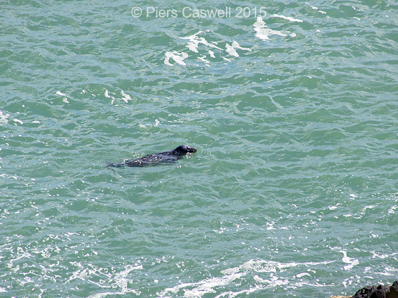
Being interested in capturing nature’s wonder, we decided to go off track and investigate further down this steep old weathered footpath through the heathers. As we descended, I looked up for a moment and caught a glimpse of this large brown object bobbing along in the surf, only moments later it had gone.
For years we have always wanted to spot Seals and Dolphins off the coast of the British Isle’s and never had much luck. Being all excited I was telling Sherrie to “look over there” and typically it had gone, casting that moment of doubt… did I actually see it.
-
- Grey seal bobbing along near Pwll Hir
-
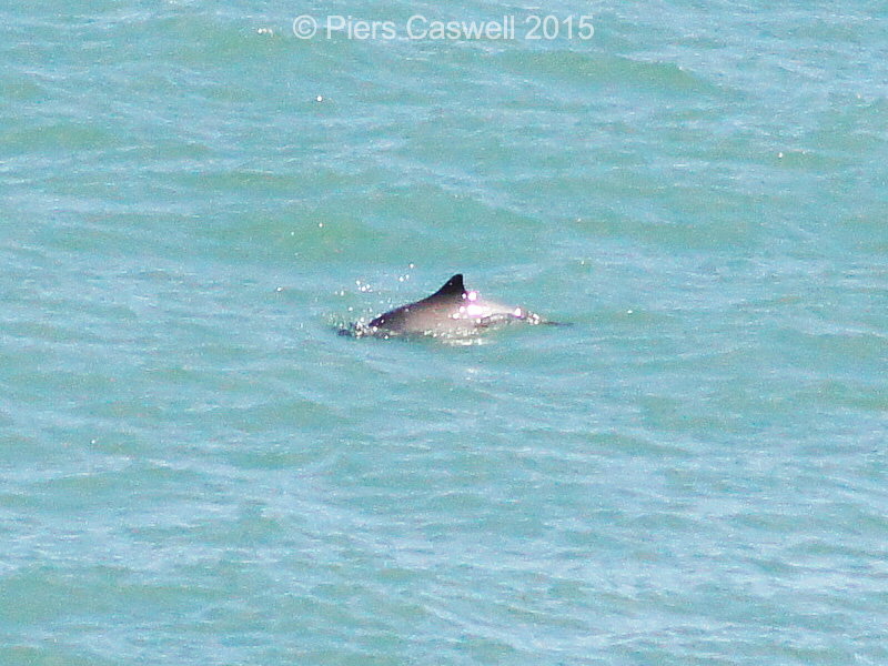
- Porpoise playing near Goodwick
-
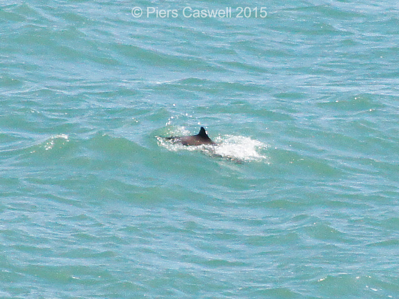
- Another Porpoise near Pwll Hir
-
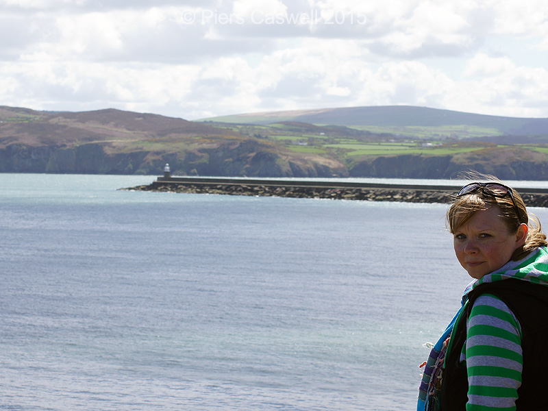
- Sherrie seal and porpoise spotting
We descended further and I spotted it again, but this time further out and it had a dorsal fin! So almost in amazement I was fairly confident that I had seen a seal and a dolphin (turns out it’s a porpoise) within in minutes in such close proximity. So out with the picnic and an early lunch (we had only just started the walk) to spend some time spotting and taking snaps of anything that moved. We were lucky enough to see 3 porpoise’s and one grey seal and an aerial display of guillemots, fabulous!
Back on the trail through Pen Anglas onto Carnfathach
Refuelled and reinvigorated we were off through National Trust’s Pen Anglas, with beautiful views over Anglas Bay and Porth Maen.
As you can see in many of the photos, on a nice day the colours are rich and full of vibrancy, such majestic views to feed the soul.. Today was a good day!
Which had now become even better, as we were approaching Carnfathach with views over Maen Jaspis, we spotted another grey seal basking in the sunshine. We said to one another at the time, this is clearly the best coastal path we’ve walked for seal spotting.
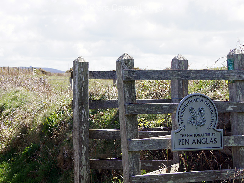
Good old National Trust!
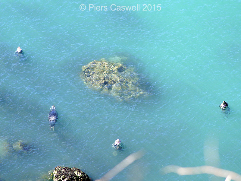
That was not the half of it, only a mile or so later as we approached Aber Felin I spotted 4 more grey seals all basking together in a small cove. With my zoom lens on, I was snapping away relishing in the moment!
-
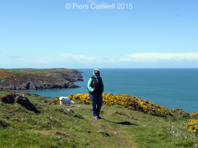
- Behind Sherrie is Carreg Wastad point
-
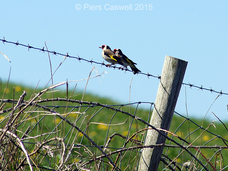
- A pair of noisy little Goldfinches
-
- 4 grey seals basking in the cove
-
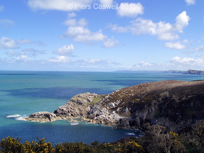
- Views over Ogof (Cave) Philip and beyond
A group of walkers approached and as they passed, they were telling us about all the seals in the cove, to which we mentioned the porpoises we’d seen, that was it they were off at speed to catch a glimpse.
After all that sun, If you needed a little fun in the shade
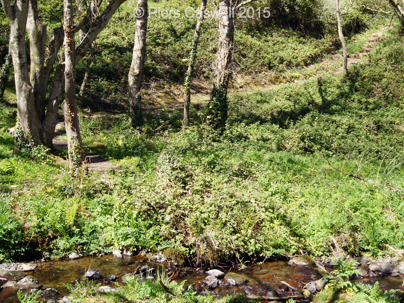
At this point, you could either make your way back or descend down a valley and up the other side to Carreg Wastad point, we decided that as we have come all this way, we should check it out.
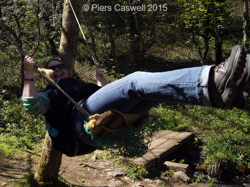
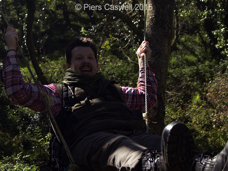
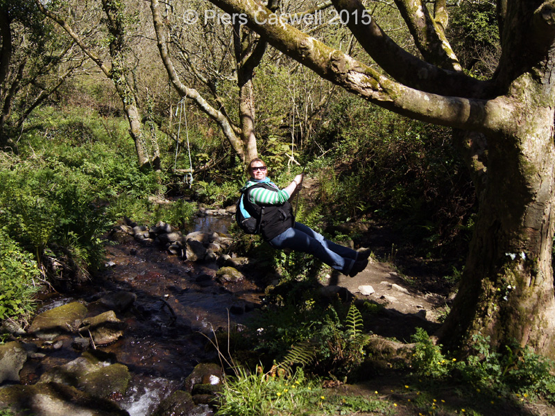
What a good call, soon as you descend down to cross a stream (Cwm Felin) you pass a series of rope swings, ah perfect for that quick flash back of nostalgia, to bring back the kid in you! Sherrie and I decided to make the most of this opportunity and cool off swinging under the trees.
-
- Swinging away on the big swing at Cwm Felin
-
- My turn to test out this swing (will it hold)
-
- Testing out the smaller swing over the stream
-
- Up out of the valley to Carreg Wastad point
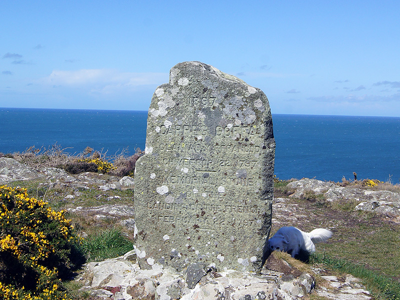
Carreg Wastad point, aside from a stone what’s it all about?
After finally dragging ourselves off the swings, we started the climb up out of the valley into vibrant yellow heathers and into what felt like a gusty storm, but was an extremely windswept open peninsula. It was certainly windy and required a steady footing, but the all surrounding views were magnificent, with this large stone engraved monument standing proud overlooking the point.
Apparently the monument (Carreg Goffa erected in 1897) commemorates the French republican La Légion Noire (The Black Legion) landing in 1797, during the last invasion of Britain. After a couple of days of looting and drinking, they were captured by a volunteer Yeoman Cavalry that were formed in 1794 by Lord Milford.
I have read that, the history behind it has been recreated in a 30 metre long Fishguard tapestry, that’s displayed in the local town hall.
Did you know
A more creative interpretation, was that they surrendered after mistaking a group of Welsh women in their traditional costumes, wearing red cloaks and tall hats for a company of soldiers.
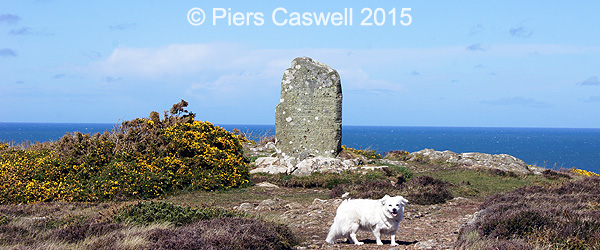
Carreg Goffa monument at Carreg Wastad point
Walking back through Llanwnda towards Goodwick
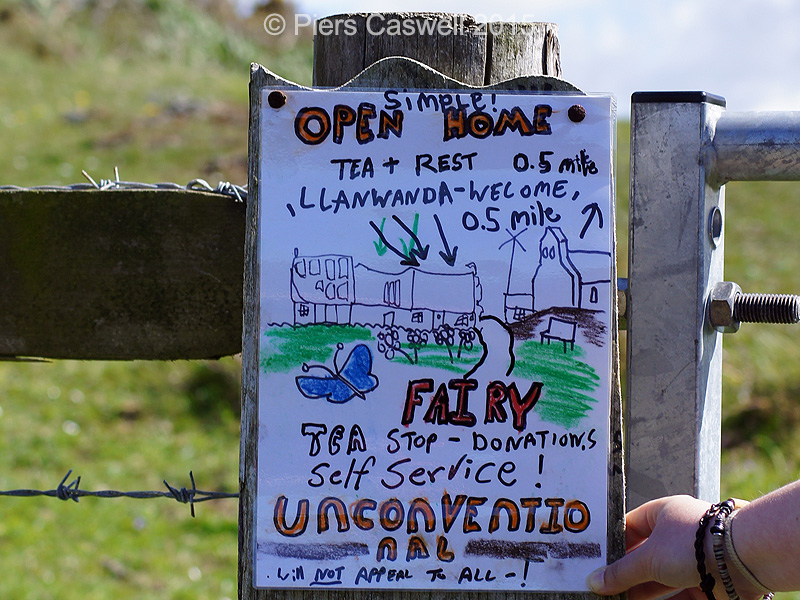
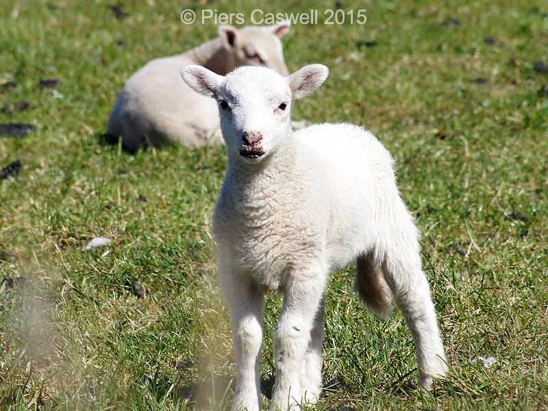
The final stretch back took us through Llanwnda farm and village past hundreds of lambs, where they offered self-service teas in someone’s house, with an honesty (donations) box. The sign (see pic below) even says:
“Unconventional, will not appeal to all”
Which we both felt a little uncomfortable just walking into someone’s house and helping ourselves, so we continued on passed Garnwnda burial chamber on through Penrhiw Farm who is an organic milk supplier to Rachels Organic. After leaving the farm you descend back down into Goodwick passing near the Garn Wen Cromlechs burial chambers.
Did you know
Denys Corbett Wilson made the first UK to Ireland flight in a Bleriot XI on April 22nd 1912 (took him 100 minutes) from a field just after Penrhiw Farm.
-
- Anyone for refreshments?
-
- Lamb at Llanwnda Farm
-
- Garnwnda Burial Chamber
-
- View over Goodwick
Walk review: Goodwick and Carregwastad point
A thoroughly enjoyable walk on a nice bright day, though we both preferred the first half with so much to see and do (swinging away), than the second half. The display of wildlife alone made the walk memorable, aside from the beauty of the rugged coastline and the salty seas.
It has plenty of steep ascents and descents, which could be challenging for some and requires a degree of stamina. Not that it was difficult, but it will work your legs and knees, especially if you take the longer route by parking down by the sea instead of up the hill where the guide book suggests.
| Scenery: |  |
| Enjoyability: |  |
| Points of interest: | |
| Average: |  |
Goodwick and Carregwastad point walk details
Here are the walk specifics collated from several different written sources, which include the readings from our pedometers on our ramble. For more detailed information please purchase one of these fantastic walking guides or source the information on-line.
Distance
5 Miles (8.04km)
Our route was 7.54 Miles (12.1 km)
Time required
3 hours on an average pace and good weather conditions.
(keeping swinging to a minimum)
Gradient / Ascent
272 Metres (894 ft)
Parking
Spaces available in Harbour village or down in Goodwick.
Food / Refreshments
Yes either in Goodwick or the self-service drinks in the home in Llanwnda village.
Difficulty
Moderate, with plenty of ascents and descents. Much more challenging on a windy day.
Acessibility / Path
Not wheelchair friendly. Coastal paths and tracks across farmland, with a couple of minor roads.
Dog friendly
Yes, but keep on a lead through Llanwnda farm and Penrihw farm!
Toilets
No, only in Goodwick car park
Here is a link to our walk recorded on our MapMyWalk app, so here is a link to the recorded walk specifics.
I have included a link to the traditional walking guide map from our Pathfinder Pembrokeshire and Carmarthenshire Pathfinder guide book.
We big fans of purchasing walking guide books and ticking off the walks we have completed, so why not grab a copy of this one!

Image source: Pathfinder Guides
On the right is appropriate quick link Google map for Goodwick, which is the area in which we parked and started our walk.
The car park in Goodwick is right on the waterfront, you can’t miss it as you drive in.
Public Transport
This walk is easily accessible via public transport using the following services:
- Train Station: Nearest is Fishguard and Goodwick
- Bus services: The Parrag – TrawsCymru T5 (400, 410 & 413)
Travelling by car
Arriving by car, there is parking available at Goodwick Pay & Display
- Coordinates: 52.002963, -4.992242
- Nearest post code: SA64 0DE
Related Posts
 Wonderful walks around Newcastle Emlyn in the Teifi Valley
- Exploring the Pembrokeshire coastal path at Moylgrove
- The Castle, the dragon & the white horse Uffington
- We found there was Plenty of things to do near Swindon
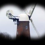
- Off wandering around Wiltshire, with Wilton Windmill in sight
- Sunday walks around Newbury & the perfect pub lunch